Aberdeenshire in Scotland has been the most badly hit area
About 2,000 homes which lost power during Storm Otto had still not been reconnected to the grid on Saturday morning.
The Met Office said the storm has “well and truly cleared” but around 2,000 homes in Aberdeenshire remain without power.
The forecasting body said the storm, which left more than 60,000 homes without power, has moved onto the continent and is now affecting Scandinavia.
Scottish and Southern Electricity Networks (SSEN) said it had restored power to around 41,000 homes since the storm struck and hopes to reconnect those still without power by the end of Saturday.
SSEN said it has sent food vans to the main areas still cut off from supply and they will serve food and drink from 8am on Saturday.
A yellow warning for snow and ice was in place for central parts of Scotland until 9am on Saturday but milder conditions are expected over the weekend.
Gusts of 83mph were recorded in Inverbervie, Aberdeenshire, while wind speed exceeded 70mph across much of Yorkshire and Northumberland.
Trains and flights were cancelled and roads blocked by overturned lorries in northern England during the storm.
In England, Northern Powergrid said about 21,000 customers lost power, with one person still affected by 8.30am on Saturday.
A spokesperson said: “It was a fantastic effort by our teams to restore power to 21,595 customers as a result of the storm, across what was a challenging day.”
On Friday morning, a man was taken to hospital in a serious condition after a tree fell on a street in Sheffield.
South Yorkshire Police officers were called to Endcliffe Vale Road at 8.50am.
A spokesperson said: “A man in his 50s was injured and was taken to hospital in serious condition. A property nearby was also damaged and structural engineers are at the scene.”
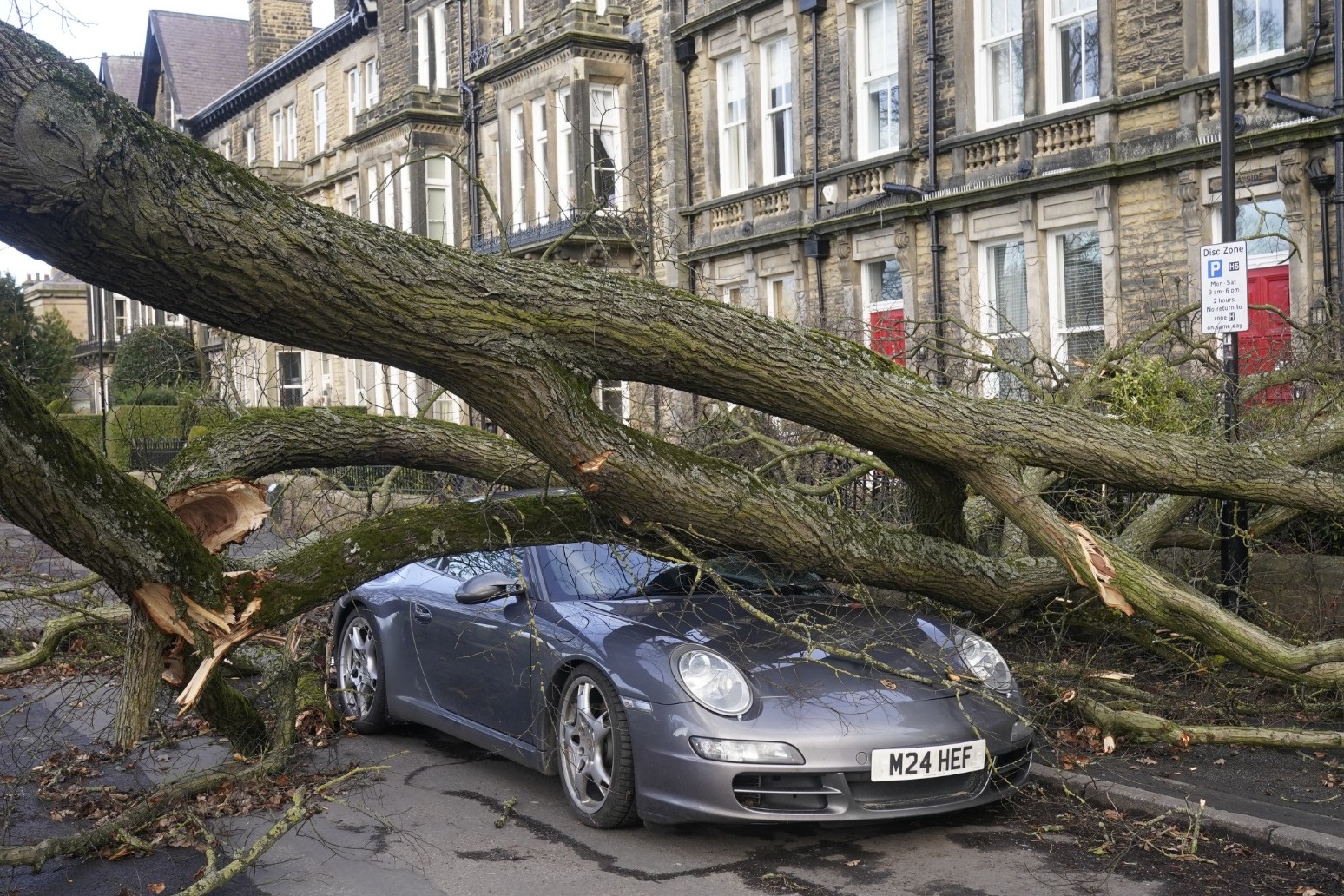
A tree toppled on to a Porsche on Granby Road in Harrogate, North Yorkshire, causing anxiety for drivers in the area.
Charlie Lowe, a 29-year-old cake business owner, photographed the crushed Porsche on her way to work, telling the PA news agency: “I felt shocked and I think it’s nerve-wracking.
“I felt a bit nervous driving around Harrogate as a result.”
On Friday evening, the mercury plunged to -3.1C (26.42F) in Altnaharra in the Highlands but did not fall below 11C (51.8F) in London’s St James’s Park.
The wettest spot was Spadeadam, Cumbria, where 18.8mm of rain fell.
Met Office meteorologist Craig Snell said Saturday would remain “breezy” in some places, particularly along the west coast, but nothing “on the scale that we have had”.
Temperatures are expected to reach 14C (57.2F) to 16C (60.8F) in Herefordshire on Saturday and sunny spells are expected in southern England.
However, the Met Office has issued a yellow weather warning for ice across parts of northern Scotland for between midnight and 8am on Sunday.
Mr Snell said: “For many of us, for the time of year, it is not a bad February day.
“Tomorrow across England and Wales it is going to be a fairly decent day if you like bright and mild weather, with a lot of sunshine.
“Scotland and Northern Ireland are a bit cloudier, wetter and windier, with a risk of gales but not on the scale we saw with Otto.
“On Sunday temperatures will be fairly mild and will reach 14-15C in southern and western England.
“Next week it is set to turn a good deal colder.”
The storm, the first to be named this winter, was labelled Otto by the Danish Meteorological Institute (DMI).
It is the first named storm to directly affect the UK this storm-naming season, which began in September.
The first storm to be named by the Met Office, or the Irish and Dutch weather services, this season will still be Storm Antoni, in accordance with the 2022/23 storm name list.
Published: by Radio NewsHub


